
Pinnacle Drone Solutions
Construction Mapping
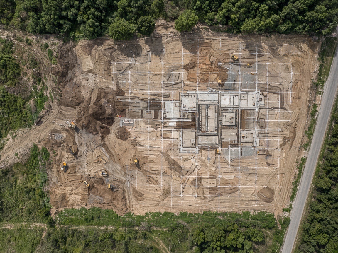
Construction mapping that turns each flight into a comparable record of earthwork, structure, and laydown. We fly the same grid over time so superintendents and owners can measure progress without walking every acre.
Scope of work
- Weekly or milestone progress flights
- Orthomosaics aligned to the same site grid
- Earthwork and stockpile visual records
- Shareable maps for owners, GCs, and subs
What your proposal includes
- Coverage areaAcres, corridors & assets
- SensorsSpecified by application
- Flight windowKeeps site operational
- ScheduleBriefing to handover
- TurnaroundTypically 48 hours
How we work
A five-stage delivery process
Predictable execution from first briefing to processed deliverables — documented at every stage.
-
01
Mission briefing
We walk the site or review plans, confirm airspace, access, and the data you need before quoting a flight window.
-
02
Scope & proposal
You receive a written scope with sensors, coverage area, deliverable formats, and pricing — typically within 48 hours.
-
03
Flight planning
We file authorizations, set ground control if required, and coordinate with site safety so operations stay open.
-
04
Capture
Certified pilots fly the planned grid or inspection path with the specified camera, thermal, or LiDAR payload.
-
05
Deliverables & handover
Imagery, orthomosaics, models, and reports are processed, QA'd, and delivered with a documented closeout.
Related capabilities
Pair with
Where we work
Construction Mapping in 2 markets
Select a market for local contact details.
FAQ
Construction Mapping questions
How quickly can you provide a proposal?
Most commercial proposals are delivered within 48 hours of the mission briefing. Multi-site or specialized sensor programs may take slightly longer because each location is scoped for airspace, access, and deliverables individually.
Can you fly while our jobsite stays open?
Yes. We plan flight windows around active work, coordinate with site safety, and keep crews and equipment out of the operating area. Dawn, dusk, and weekend windows are available in both markets we serve.
Are your pilots FAA certified and insured?
Every mission is flown by FAA Part 107 certified remote pilots with commercial liability coverage. We complete vendor onboarding, insurance certificates, and safety documentation for GCs, energy operators, and property managers.
What deliverables do we receive?
Typical packages include high-resolution stills, video, orthomosaics, 3D models, thermal reports, or LiDAR point clouds depending on the service line. Formats and accuracy targets are written into the proposal before we fly.
Get your construction mapping proposal
Request a site assessment and receive a written scope with sensors, coverage, deliverables, and pricing — typically within 48 hours.